
Los Angeles County ZIP Code Directory
Los Angeles County has 88 cities, unincorporated communities, mountain and desert settlements, islands, and postal labels that do not always match municipal borders. The ranges below are research categories, not an exhaustive live USPS roster. They show where a searcher is likely to encounter different geography problems.
| ZIP family or example | Areas commonly represented | Post-office note | Research caution |
|---|---|---|---|
| 90001-90068 | Central, south, east, west, and Hollywood-area Los Angeles communities | Many LA stations | Ranges include exceptions and some unincorporated areas |
| 90069-90099 | West and central Los Angeles, institutions, special assignments | Station or unique use varies | Do not treat a special code as a neighborhood polygon |
| 902xx | West and southwest county, gateway and South Bay communities | Local post offices | Postal city and incorporated boundary can differ |
| 903xx-908xx | Inglewood, Hawthorne, Torrance, southeast county, Whittier, Norwalk, Long Beach | Multiple city stations | Boundary parcels need a city or GIS check |
| 910xx-918xx | Foothill, San Gabriel Valley, Glendale, and eastern county communities | Local stations | Community labels and county lines interlock |
| 913xx-916xx | San Fernando Valley, Santa Clarita, and north county communities | Multiple stations | City of Los Angeles and independent cities share the region |
| 93243 and 935xx | North county, high desert, and Antelope Valley communities | Rural and local stations | Large service areas make ZCTA and delivery-code checks important |
A current exact ZIP comes from the address, not from a family name or a city label. This Los Angeles County ZIP code directory treats unique and PO-box codes as separate research clues because they may not map to a residential neighborhood at all.
Los Angeles County ZIP Verification
The Los Angeles County USPS lookup is the first check for a live delivery address. For Los Angeles County ZIP code verification, enter the exact street address for an address-to-ZIP result, or use the city and state route when testing a postal label. Save the returned ZIP and city name with the address date. A ZIP label that says Los Angeles does not prove that the parcel lies inside the City of Los Angeles or even inside an incorporated place.
| Address lookup | Use the exact delivery address to determine the assigned ZIP. |
|---|---|
| City and state lookup | Check postal naming against a city and state combination. |
| Verification result | Use the USPS result as the delivery reference, not as a city-boundary map. |
| Research note | Recheck when a parcel, city line, or historical address has changed. |
The image below is linked to the official USPS ZIP Code Lookup.
USPS confirms delivery geography. It does not return a list of residents, owners, or household members.
Finding Los Angeles County Residents by ZIP
A Los Angeles County ZIP-filtered resident search must stay modest. The Assessor can begin with an address or AIN and return parcel facts. GIS can show the parcel pattern and available layers. The county voter page can verify one known person only when the last name, birthdate, house number, and ZIP are already known. A qualified voter-file order has statutory purpose and certification rules. No public portal produces a complete ZIP-wide resident list.
- Verify the exact address and ZIP through USPS.
- Use the Assessor or GIS to identify the parcel and jurisdiction.
- Compare a known name with the county's four-field voter self-check only when all inputs are already in hand.
- Use court, license, business, probate, or historical sources to corroborate a person, not to fill a ZIP roster.
- Move from a ZIP to a street only after the city and parcel are clear.
Once one ZIP narrows the geography, the Los Angeles County by-street records chain handles the address-level work.
Los Angeles County ZIP Geography
Los Angeles County ZIP Codes route mail. They are not municipal boundaries, census tracts, school districts, or assessor neighborhoods. A parcel may use a postal city that differs from its incorporated city. An unincorporated pocket can share a postal label with a nearby city. A City of Los Angeles parcel can carry a neighborhood postal name. Those differences affect which permit office, clerk, or planning portal owns the next record.
Use “Los Angeles County” for county records, the incorporated city for municipal records, and the postal city only for mail. Store all three labels when they differ. That simple habit prevents a Los Angeles County ZIP code search from sending a Pasadena, Long Beach, Beverly Hills, Santa Monica, or unincorporated address to the wrong local custodian.
The same label can also hide a change in scale. A ZIP family is a convenient way to sort a large county, but it does not tell whether two addresses share a city council, a building department, a court location, or a school area. The parcel and the local jurisdiction must be checked before a ZIP result becomes a records request. That check keeps postal geography from masquerading as residence evidence.
Los Angeles County Special ZIPs
Los Angeles County codes can describe PO boxes, large institutions, or unique delivery assignments rather than a normal residential area. The 90090 through 90099 group includes special and PO-box uses mixed with delivery uses. Codes associated with major institutions are not neighborhood polygons. A ZIP can also cross the county line, especially in the eastern San Gabriel Valley families.
Do not infer a resident, campus, business, or neighborhood from the code alone. Confirm the exact address in USPS, then identify the parcel and jurisdiction. If there is no street delivery address, a ZIP may be a mail route without a residential geography.
- PO-box ZIP
- A code used for post-office boxes rather than a set of street-delivery parcels.
- Unique ZIP
- A special code assigned to one institution or large recipient.
- Carrier route
- A delivery route within a ZIP, not a city or parcel boundary.
Los Angeles County ZIP ZCTA Evidence
Los Angeles County Census ZCTAs are statistical approximations built from generalized geography. The 2020 ZCTA-to-county relationship file lists ZCTAs that intersect Los Angeles County, including border-crossing areas, but it is not a master list of every live USPS ZIP. It omits some unique and PO-box codes because those codes do not form normal statistical areas.
The relationship file used for the image is the Census 2020 ZCTA-to-county data, with methodology documented separately.
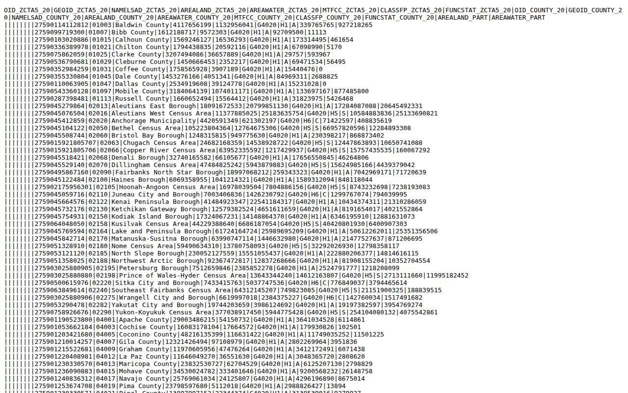
Use ZCTAs for statistical comparison and county intersection questions. Use USPS for a live address and a parcel map for property geography.
Los Angeles County ZIP and GIS
The Los Angeles County Assessor map and LA County GIS Data Portal can resolve a ZIP-versus-city question after an address is known. Search the address or AIN, click the parcel, and inspect available city, unincorporated-community, zoning, district, census, hazard, and aerial layers. Record the map date. Layer availability changes, and a map polygon is not a survey or deed.
LA County Planning's T06 map overlays ZIP and incorporated or unincorporated boundaries. It was revised in March 2022 and is a geographic reference, not proof of current USPS delivery. A live postal lookup remains the final step for a current mailing address.
The county's official 2020 intersection list includes examples such as 90001, 90201, 90301 through 90305, 90401 through 90405, 90501 through 90506, 90802 through 90808, 91301 through 91304, 91702, 91801, 93243, and 93550 through 93553. Those examples show the spread of Los Angeles County geography, but not every active delivery code. Border-crossing ZCTAs and special codes must be labeled as such.
Unincorporated addressing has another layer. The County Public Works Street Name and House Numbering Unit is identified at 900 South Fremont Avenue in Alhambra. The research notes an Antelope Valley alphanumeric plan, a general practice of calling east-west routes streets and north-south routes avenues, and separate address needs for some accessory dwelling units. Incorporated cities control their own assignment.
The GIS gateway for Los Angeles County is the LA County Enterprise GIS Data Portal.
Los Angeles County ZIP History
A modern Los Angeles County ZIP code should not be carried backward into an old directory as if it were a permanent place label. Historical city directories use street forms, city or community scope, and publisher conventions. Annexation, parcel subdivision, consolidation, and street renaming can change the relationship between an address and a postal label.
Older work should retain the legal description, lot or tract, historic street form, and contemporary community name. LAPL reverse directories and city directories can supply an occupant clue, while Sanborn maps and newspapers can explain a street or building change. A current ZIP is a delivery key, not a time machine.
Los Angeles County ZIP Boundaries
ZIP boundaries and city limits disagree often enough to change a records search. A postal city can cover a county pocket. A ZIP can cross an incorporated line. A ZCTA can cross the county line. Use the postal result to route mail, the city or county label to route permits and clerk records, and the AIN to route parcel and deed research.
- ZIP versus ZIP+4
- A five-digit ZIP identifies the broad delivery area; the added four digits narrow a delivery segment.
- Postal city
- The USPS city label for delivery, which may not equal the incorporated municipality.
- ZCTA
- A Census statistical area built to approximate ZIP geography for data analysis.
- AIN
- The Assessor's parcel key, useful when postal and municipal labels conflict.
Boundary check. A ZIP Code can tell the mail carrier where to route an address. It cannot by itself tell who owns, occupies, or governs the parcel.